Tuesday, 13 August 2013

Roscoff to L'aberwrach

We left Roscoff on a hop to L'aberwrach which is a journey of approximately 43 nautical miles and involves rounding the Ile de Batz and keeping about 3 miles off the coast to avoid reefs of rock and isolated rocky outcrops.  The weather was fair and the sea quite calm and so the journey was uneventful.  This is the most exposed part of the North Brittany coast and the river at L'aberwrach is the last serious refuge before you round cape Finisterre going south..  If something goes wrong here you're on your own till the coastguard can get to you so for WAFIs ( a WAFI is a naval term for "Wind Assisted F*****G idiot") like us you don't go unless you are sure you have a good weather window.  L'aberwrach is the most common starting off point to move south towards the Rade de Brest through the dreaded Chanel Du Four.

Here are a few of the pic's we took along the way:

 
Lighthouse at Ile Vierge
This light is charted as Fl.5s77m27M
This means that it flashes every 5 secons, its light is 77 metres high (approx. 250ft) and the light can be seen for 27 miles.
WOW 
 
There aren't many lights in the English channel that can be as powerful as this.  The only ones I've seen are St.Catherines on the Isle of Wight, Barfleur near Cherbourg, Edystone and Wolf Rock.  This one is a true giant.
 
 
L'aberwrach is at the end of the dotted line
 
 
The following morning we woke to fog.


and more fog
 
 
The fog lifted so we took the opportunity to walk to a vantage point to see the view of the L'aberwrach estuary


The estuary


Time for a G & T

 
What a sky

 
Carla and Pete in Nanuk
 
Owing to the fog we stayed a day in L'aberwrach and sailed on 2nd August for Camaeret Sur Mer through the Chanel Du Four.


Important Navigation Marks


Apologies for the internet silence but we've had very little internet connection availability for some days so here is our next bit of blog.  We hope you enjoy it.

Raspberries to ROBIN!!!!!  There will be more photos of us coming up later.....we are both having a good time but missing all our family and good friends.

CARDINAL MARKS

Apologies to the sailors among our readers, you'll know all about these.  This is for the non sailors who may find it interesting or in the case of Robin it may be totally boring!!
The sea is a wonderful place to be when you are on holiday with time to consider the weather.  Shall we sail today or shan’t we?  Is there a 6 in the weather forecast?  However if you make your living by seafaring  e.g.  being a fisherman or a ships pilot or if you are a volunteer with the RNLI, your choice as to when you set sail can be severely limited.  Basically you need to be out there to make a living so it is important that everyone who goes to sea can understand the navigation marks that are placed out there to help them.  All the worlds’ major nations have therefore signed up to an agreement (IALA) that sets out the standard navigational marks that are used almost world wide.  Red marks (buoys) are port marks and green are starboard as well as lots of other standard colours and designs to indicate other important things such as submerged hazards e.g. rocks or wrecks.
Chris has become obsessed with one such marker buoy called a Cardinal.  Cardinal marks correspond with the cardinal points of the compass i.e. North, South, West and East and they are placed by the coastal authorities to indicate the presence of a submerged obstacle such as a rock or a sand bank to stop ships going aground.  They are always coloured with black and yellow hoops and have day marks on top so that in bad visibility they can be identified by the shape of their top marks.  The order of the B/Y hoops identifies the type of cardinal.  BYB is East, BY is North, YB is South and YBY is West.  They are like keep left signs in the street.  If you see a North Cardinal buoy, you keep north of it because the obstruction is to its south.  Likewise if you see a W Cardinal you keep west of it and so on.

 
A floating E cardinal buoy


A huge W Cardinal Mark
 
When sailing the south coast of the UK you’ll see cardinals quite often but here in Brittany there are so many dangerous rocks everywhere that they are found like swarms of bees.  We entered a port called Benodet and there were eight in the space of about two miles.  Quite often they are aimed at keeping ships away from danger so when you approach them in a small boat like April Dream you’ll be dwarfed by them.  They can be tall and very heavy floating objects, chained to the seabed or they can just be a painted pole stuck in the mud to keep small boats out of trouble.  We saw one coming down the Raz De Seine which was a 40ft high concrete tower looking like a Wasps Rugby shirt.

 
A huge Port Hand Mark guiding ships into l'aberwrach


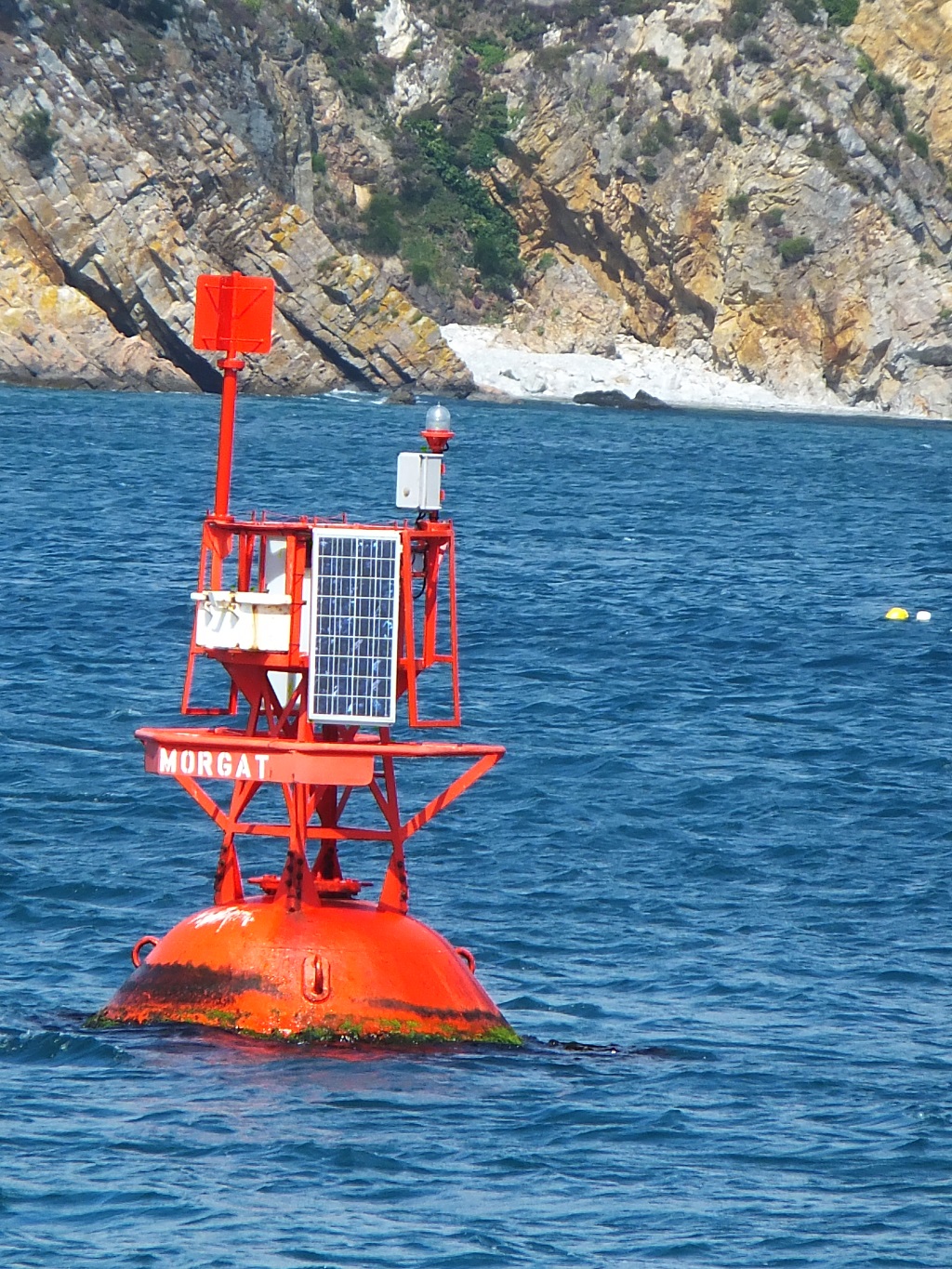
A Port Mark at Morgat
The sheer ruggedness of the Brittany coastline and the ferocity of the sea in these waters during bad weather is legendary and so the scale and design of the marks that the Bretons use is quite often massive.  Tonnes of concrete or stone used where we in UK waters might use a floating buoy instead.

 
Lighthouse at the Raz De Seine
Can you imagine this in a gale!!
 

Thursday, 1 August 2013

Roscoff and the Crab Dinner

It has become a tradition that when we are away Chris doesn't feel like she's on holiday till she has eaten some shellfish.  In this case it was Crab in a lovely restaurant in Roscoff with a sea view:


A worried crustacean
 
I hope you enjoy the following views of Roscoff


Roscoff and Ile De Batz

Roscoff and Ile De Batz 26th July till 31st July

This is just to bore Uncle Robin!!!!!!!..............  Roscoff is the port that receives the ferries from Plymouth and the new Marina de Bloscon which was built last year is ideal for visiting yachts as it is easy to access and has a free bus service into the town about one kilometre away.

On the second day there we took a small ferry to Ile de Batz which is a small island about 1.5 Km long and o.7Km wide.  Its main feature is that it has a huge lighthouse on its highest promontory and we walked there to have a look at it.

 
Ile De Batz light house
 
 
Carla decided that she was going to climb the winding staircase to the top, about 230 steps so not to be outdone I decided to go as well.  C started the ascent like a mountain goat while I plodded along behind.  I had to stop and sit down at 100 steps while my body caught up with my heart rate but the view once we got to the top was breath-taking!!   Chris and Pete were very sensible and decided to sit on a lovely picnic bench and watch the boats go by and a drink a very nice glass of beer.


The weather in Roscoff had been sunny but we ended up staying there owing to strong winds and rain.  We finally left Roscoff to sail towards L'aberwrach on 31st July.
 
We left Roscoff to round the Ile De Batz keeping well clear of all the rocky outcrops.  The wind was favourable and the weather fine and we hoped for a great sail.  However after a while the wind went into the SW - right in our face and at the same time dropped and became variable between no wind at all and as much as 20 knots.  We sailed when we could and we motored when we couldn't but it turned out to be a frustrating day for sailing. 
 
Approaching the Aber Wrach river there is a large and very dangerous reef which is identified to sailors by a huge lighthouse on Ile Vierge that can be seen for miles.  Its height above sea level is charted at 77m high and they reckon you can see the light at night from 27 miles away!! 


In English waters we have some prominent lighthouses such as Bishop Rock, Portland Bill and St Catherines but they are small when you compare it with this stone structure standing at well over 200 feet high. 
 
\we found our way into Aber Wrach (so called because historically they gathered the Wrach seaweed there) and made our way up river to the marina.  A beautiful evening with a picture postcard sunset.


The following morning we rose to a misty and foggy start which forced us to decide to stay in L'Aber Wrach for the day and set off for the Chanel Du Four in the morning.


A foggy morning in L'Aberwrach
 
To date Chris has worked out that we have done approximately 320 miles


Tuesday, 30 July 2013

Perros Guirrec to Roscoff

We left Perros Guirrec to sail towards Roscoff which is a distance of about 20 miles.  There was just enough wind to sail but only just and the forecast was for a drop in the wind later in the day.  We have a sail called a Cruising Chute which is used in light wind to gain extra speed.  It is the largest sail that we carry but we seldom use it as it can be difficult to manage with just two people.  Once the wind gets into it the strain on the ropes can be a lot and if you haven't got them all secured properly you can get into quite a bit of bother.  Anyway this day we decided it would be a good idea to hoist it and gain a bit of extra speed.

The sail is a large triangle of cloth about 50 ft from top to bottom and probably 20 ft along the bottom edge.  The plan is to get the boat running down wind with the main sail out wide and to hoist the big cruising chute behind the main, shadowed from the following wind, to prevent it from powering up before we had it all properly hoisted and set up.  Once hoisted you turn back onto your course, the sail fills and away you go. THAT IS THE PLAN but all plans are made to be rendered useless by what uncle Norman used to call THE BUGGERATION FACTOR!!

On this occasion Chris was on the helm and I was on the foredeck with the sail in its bag.  Emerging from the top of the bag are the three corners of the sail marked Head, Tack and Clew.  The head is top corner, the tack is the one that is tied down to the bow of the boat and the clew is the one that has the sheet ropes tied to it.  I connected the ropes, told Chris to set the autopilot to sail on a run and she hoisted the sail by pulling un the halyard.

WELL, I don't know what happened but the sail came out of the bag twisted in a knot, just at that moment the wind shifted so that the chute was no longer shadowed by the main, the sail filled and got itself tangled around the baby-stay and we were in a bit of bother.  I'm sure that at one point I was wrapped in sailcloth like a mummy and the only features visible was my beer belly and glasses.  Chris quickly got the boat back on the run but I couldn't get the sail un-knotted.  No matter how much I swore at it it refused to obey and just seemed to have a mind of it's own.  Eventually, after much faffing and cursing I got the sail down and we tried it all over again.  The same thing happened so we gave up and decided it was all too difficult with the wind shifting as it was so we motored the rest of the way.

Roscoff

Roscoff is an old town with a ferry port, Brittany Ferries run their service from Plymouth but when you look at the coastline it is surprising that you can navigate a ship in there as the rocks and shallows all around look horrendous.  Up till last year there was no marina so your only option as a small, visiting boat was to anchor but they have now built a brand new marina.  The major parts of it are finished but the facilities are not.  Showers and toilets are currently in portacabins and the capitainery is likewise in temporary accommodation.

It is quite a game going to the loo.  When you open the door and walk into a cubicle and shut the door behind you there is so little room that you can't bend down to retrieve your shorts from around your ankles.

Likewise in the showers there is no seat or shelf to put your wash-bag on, there are a couple of hooks for clothes and the floor is a cm deep in water because there are no shower doors and the water sprays everywhere.  When we arrived it was the day before the start of a big yacht race and there were about 100 extra people (visiting race crews) to accommodate so to get a shower took forever and when you did get in there the water was cold.

However Roscoff is a wonderful place dating back a long time.  There are wonderful old stone buildings and streets all cobbled with granite.  There are two harbours, one is the new marina mentioned earlier and the other is a drying harbour dating back to the year dot.

 
Roscoff old harbour
 
 
Old harbour
 
 
On the day after we arrived there was the start of the Yacht Race and we walked down to the town to see the racing.

 
vantage point for seeing the racing


Yacht Race
 
More to come later re-Roscoff ..................................
 

Saturday, 27 July 2013

Jersey to Lezardrieux to Perros Guirrec


JERSEY  TO LEZARDRIEUX TO PERROS GUIRREC


The four of us on Jersey with Gorey Castle in background.
 

Replacing a bent bottle screw

In my last posting I mentioned the accident with the rafted boats.  The boats were moored up together in calm conditions with ropes tying them together.  Once we had moved to St.Helier we noticed that one of these ropes had been tugged to breaking point as the wind increased and the shock had bent a 12mm diameter bottle screw.  The bottle screws are the adjustable bolts that connect the mast shrouds to the deck of the boat, in effect they hold up the mast.  The bent screw was not showing signs of cracking but you never know so I decided to replace it.  A sail boat mast like ours is held vertical by a number of guy wires called shrouds and stays.  There is a front stay, a back stay and in our case a port and a starboard cap shroud which is connected to the top of the mast and a port and starboard inner shroud connected just below the mast spreaders.  The shroud that had been damaged was the inner starboard one and I didn’t know whether the mast would be stable if I detached it.  I thought that the cap shroud would be strong enough but I needed some moral support so Chris and I spent a day visiting marine engineers and asking questions.  We decided that the mast was probably strong enough to support itself without the inner but to be absolutely sure we took all the halyards from the top of the mast to the starboard toe rail and winched them up as tight as we could to replace the effect of the bent shroud.  Once these were in place I very gingerly loosened the bottle screw checking that there was no movement at all which gave me the confidence to undo it completely and replace the bent component.

 
The bent screw takes tons of pressure
 
 
A bottle screw
 
Evenings aboard

Evenings can get expensive if you decide to eat out all the time so a variety of activities always are on offer such as Scrabble and Rummicub.


Miss Carla pretending she isn't competitive!!
 

Jersey to Lesardrieux – Monday 22nd July

We intended to leave St.Helier for a night crossing to Lezardrieux which meant that we had to get out of the inner harbour in the afternoon, as it is behind a sill, and wait in the outer harbour till the tidal flow was right.  In the English Channel you basically travel east/south on a dropping tide and north/west on a rising tide.  The Channel Islands have very strong tides and if you get it wrong you can be there sailing full pelt but actually going nowhere so we waited for the tide.  We planned to cast off at about 7.30 pm but a large thunder storm developed so we decided that we would stay put till the morning tide.  Chris and I set about filling water tanks and pumping out holding tanks ready to leave at 7.30 am the following morning.

So the time arrived and we cast off and sailed out of St.Helier.  Weather was set fair but with a risk of mist or fog patches so we had our radar switched on in case visibility was poor.  As we emerged from the harbour we had to avoid the Fast Cat – the huge catamaran passenger ferry that docks there.  It loomed out of the mist blowing it’s fog horn and the 3 or 4 little boats which were accompanying us all scattered in different directions to get out of its way.  After that we set our course to run outside the shipping channel in the shallower water where the big ships can’t go and we proceeded down the coast leaving La Corbierre lighthouse behind us (though we never saw it in the mist) and set a course of 2400 (T) towards Lezardrieux.  Visibility was pretty poor all day ranging from about 100m at worst to a couple of miles at best.  We kept track on the GPS plotter and kept an eye on Pete and Carla in NANUK on the radar. 

 
Chris at the helm.


Chris on watch.


The entrance to the River Trieux on which Lezardrieux sits is surrounded by rocks and craggy outcrops and the Ile De Brehat and the tides run past the entrance at an alarming rate.  We arrived just as the tide was about to turn against us and even then we had speed through the water of 6 knots but a ground speed of as little as 2 Knots until we got into the river.  NANUK, Pete and Carla’s boat has a smaller engine than ours and was hardly able to make way at all.  We got into the harbour at about 6pm but they were two and a half hours behind by which time the seagoing current in the river prevented them from coming up stream so they decided to find an anchorage and come up the river the following day when the tide was with them.


Lezardrieux is a small village with a church, a couple of shops and a small supermarket, the River Trieux is what we in the UK would call an SSSI (site of special scientific interest).  The charts refer to it as a site of marine culture.  There are oyster beds, fish farms, wetlands and loads and loads of sailing craft from historic old gaffers to shiny new pleasure craft.  A very picturesque river but a very unforgiving one if you get your passage planning wrong.


The marina is situated about two or three miles up stram and you have to remember that the tide runs through the moored up boats just as fast as it does in the main river.  Also the rise and fall of the tides is very significant.


You can see the ramp down to the pontoon.  This is at about one third of the tide.  At high tide the ramp is horizontal and at low tide it is approx. 40 degrees.  The sea wall that you can see in the background has about another 1.5m of rocks showing at low tide.


Chris and Simon with beers!!

 
The Dreaded Coifficient

Tides and tidal streams are subject to variations which you probably know are called Neaps and Springs.  A spring tide commonly occurs 2 days after a full moon and a neap occurs basically half way between 2 springs.  However some springs are bigger than others and the North Brittany coast has some of the biggest tides in the world and so a 5% increase, which in the Solent would hardly be noticed, on the Brittany coast can cause disruption and ferocious tides.  We happened to go to Lezardrieux when the biggest tide of the year was expected which I think is why Pete and Carla had such a difficult time getting in to the river that night.  The French refer to these differences of tidal height by a system called coefficients.  The coefficient starts at 20 and goes up to 120 and the day we arrived it was 107.  The mean is considered to be 95 for a spring so this tide was approximately 13% bigger than usual.

That evening we were sat in a bar by the harbour and the tide came right up to the top of the sea wall and flooded the car park and two or three people had to paddle to get their cars out.

David and Sarah – Wednesday 24th July
left to right:   Simon, David and Peter

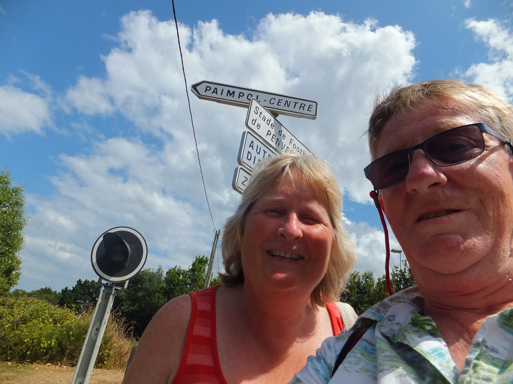
Carla and Pete have some friends who live near Paimpol so the following day we invited them over and went out for a meal at the harbour restaurant.  They all had Moules et Frites (yuk) I had a pizza.  Seriously though, it was a great evening and we all laughed a lot.  The following day they invited us to their house and so Pete and Carla went early to see Paimpol town and harbour and we stayed to do some chores on the boat.  Swabbing the decks and stowing loads of stuff used over the last day or so.  We agreed to meet them later only to find that there were hardly any buses so we decided to walk the 5Km through very picturesque countryside.  The hydrangeas and honeysuckle and sweet peas with their vivid colours were wonderful.  Chris and I were a little knackered after the walk as it felt a lot longer than 5K (Chris put this in)....... my sole contribution so far!!!!
 
Bridge at Lezardrieux


River upstream from Lezardrieux at low water


Landmarks on our walk
 
David and Sarah had two old friends staying with them called Anth (Anthea) and Sue who were on a cycling holiday and they joined us for supper as well.  We all seemed to laugh all evening, a great time was had by all.


LEZARDRIEX to PERROS-GUIREC – Thursday 25th July

Having come to terms with the tides at Lesardrieux we managed to make our exit from the river and headed west with the tide approximately 25 miles to Perros-Guirec where we anchored in the bay for the night.  The extremely low tide meant we were anchoring in about 2.5m and the tide woulf rise to about 12m so we had quite a range to deal with.  The rule of thumb is that you let out chain equivalent to 3 x depth at high tide (known as the rode) so we were anchored on 30m of chain so at low tide we had a 60m circle. 

 
NANUK under sail
 
 
'April Dream' under sail


When sailing you see many contrasting things.  Sometimes you'll see a modern cargo ship then you might see something like this making it's way to Roscoff.
 
 
Square rigger off Perros Guirrec
 
 
Weather worn scenery


This is the furthest west we have been on the French coast.  Xxxx